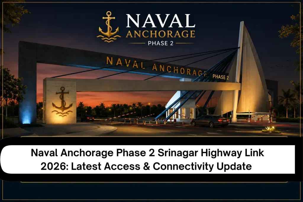
Buyers looking at Naval Anchorage Phase 2 often face the same practical problem. A location pin on a map shows where the project sits, yet it rarely explains how easily you can actually reach it day after day. Road connectivity shapes daily travel, accessibility and the real-world usefulness of any plot. Naval Anchorage Connectivity centres on its connection with Srinagar Highway Islamabad and the wider road network around the Thalian area. This article clarifies the access routes, the nature of the highway link, what a proper Naval Anchorage Connectivity Map should show, and the specific checks buyers need to complete before relying on any claimed connection. You can also review the official location details for supporting context.
Naval Anchorage Srinagar Highway Link: What Does It Actually Mean?
The Naval Anchorage Link to Srinagar Highway does not mean a private gate opens straight onto the highway itself. It means residents can reach Srinagar Highway within a short drive, currently estimated around 12 minutes under normal conditions. From that point the highway offers a largely signal-free corridor into central Islamabad.
Buyers should treat this as an approach route rather than a direct interchange. Verified access begins at the Thalian Interchange on the M-2 Motorway, which sits only a couple of minutes from the main entrance of the project. From there the local road network connects onward toward Srinagar Highway. Highway Access therefore depends on the quality and current condition of the approach roads, not simply on map proximity. Always separate verified road access from assumptions based on older planning documents. For more background on this positioning, see the post on strategic location near the Thalian Interchange and the related discussion of Thalian Interchange development and Naval Anchorage.
In practice, the difference between “near the highway” and “easy highway access” matters. A buyer who only looks at distance may overlook the actual entrance road or temporary construction that affects daily use. Checking the current route on the ground remains the most reliable step.
Naval Anchorage Connectivity Map: Understanding the Route
A Naval Anchorage Connectivity Map helps answer the most practical question buyers ask: how do I actually reach the project? The main approach starts at the Thalian Interchange. Srinagar Highway sits a short distance further along the wider road network. Buyers should examine the full route rather than a single location pin.
Key elements to note include:
- Direct entry from the Thalian Interchange on the M-2 Motorway
- Short onward connection toward Srinagar Highway Islamabad
- Links into the broader Islamabad Roads and motorway system
- Proximity to Airport Road and developing Ring Road segments
- Clear distinction between existing roads and any future planned corridors
Looking at the complete road network on an updated map gives a clearer picture than any isolated claim of connectivity. The project’s own master plan and the dedicated Naval Anchorage Phase 2 map post provide useful visual references. However, it is important to confirm with a map drawn from an alternative source as road access and conditions may change.
Look carefully at the entrance when studying the map. The wide approach road is very convenient for daily use. A narrow or incomplete road reduces the practical value of even a strong highway connection.
How Srinagar Highway Improves Naval Anchorage Access
Srinagar Highway improves practical access toward central Islamabad. Once residents reach the highway, travel toward Blue Area and Zero Point becomes more straightforward and largely signal-free. Current project information estimates the drive at around 25 minutes under normal traffic.
Highway Access also supports commuting in both directions. A highway nearby sounds useful, but the real question is how easily you can reach it from the project’s entrance. In practice, the short drive from Thalian Interchange to Srinagar Highway reduces the friction of daily travel. Road Connectivity therefore matters more for routine convenience than for long-distance journeys alone. At the same time, actual travel times always depend on traffic and road conditions on the day.
This connectivity also supports movement toward the airport corridor. Residents who travel frequently benefit from the combination of motorway access and the relatively short link to Srinagar Highway. For broader context on how the area fits into regional growth, the post on airport corridor development in Naval Anchorage Phase 2 offers additional perspective. The overall Naval Anchorage Islamabad 2026 overview also places these routes in a wider frame.
Major Roads Connected to Naval Anchorage
Several roads form the practical network around the project. Each serves a different purpose for residents and visitors. Understanding what each road actually helps you do is more useful than simply listing names.
Srinagar Highway
This provides the main corridor into central Islamabad. Once reached, it supports smoother travel toward government offices, commercial areas and major institutions. The largely signal-free character of the route is one of its practical advantages for daily commuting.
Main Access Roads
The Thalian Interchange and the short approach from the M-2 Motorway form the primary entry. These roads give the most direct Highway Link for most buyers arriving from the motorway network. The quality of this short approach road strongly influences how convenient the entire connection feels.
Key Connecting Routes
Airport Road keeps the Islamabad International Airport within roughly 5–8 minutes. Developing segments of the Rawalpindi Ring Road and Chakri Road expand options toward Rawalpindi and surrounding areas. Together these routes create the wider Islamabad Connectivity that supports both daily life and occasional longer trips. Further detail on how these roads fit the overall picture appears in the development update of Naval Anchorage Phase 2 and the Naval Anchorage Phase 2 growth discussion.
Naval Anchorage Islamabad: How Convenient Is the Location?
Naval Anchorage Islamabad sits in a developing western corridor near Thalian. Accessibility for residents depends on the quality of the entrance roads and the condition of the connecting network. Commuting considerations include the short hop to Srinagar Highway and the motorway options for longer journeys.
Location should be judged by route quality rather than distance alone. First-time buyers should drive the actual approach at different times of day. They should also confirm the current status of any supporting roads. Naval Anchorage Connectivity works best when the approach roads remain clear and well maintained.
For families the practical question often becomes whether the daily commute feels manageable. For professionals who travel frequently, the combination of motorway and highway access carries more weight. The post describing Naval Anchorage as a practical choice for families explores this balance in more detail. You can also review the broader about us page for background on the project’s positioning.
Does the Srinagar Highway Link Matter for Property Buyers?
Accessibility influences property decisions because it affects daily usability. Better road connectivity can make a location more practical for families and professionals. Potential benefits include easier commuting and reduced dependence on congested inner-city routes.
However, connectivity alone does not guarantee appreciation. Buyers should also evaluate development progress, legal approvals, possession timelines, utilities and actual market demand. Highway Access is one useful factor among several. A balanced view treats the Srinagar Highway connection as a practical advantage rather than the sole reason to buy.
Investors sometimes over-weight a single highway link while under-weighting other fundamentals. The more useful approach is to treat connectivity as one supporting element. For deeper discussion of investment considerations, see the anchorage phase 2 investment guide Islamabad and the Naval Anchorage Phase 2 investment in Islamabad 2026 overview. The Naval Anchorage investment 2026 post also provides additional context.
What Buyers Should Verify Before Relying on the Highway Link
Before placing weight on any connectivity claim, complete these practical checks:
- Verify the latest official or project-provided map
- Check the actual entrance and approach road in person
- Confirm whether the claimed highway connection is currently usable
- Check the present condition of the approach roads
- Compare the stated route with an updated digital map
- Note whether any route has changed from earlier master plans
- Confirm development and approval information from authoritative sources
These steps turn a map claim into usable knowledge. They also reduce the risk of relying on outdated information. Buyers who complete this checklist usually make clearer decisions than those who rely only on promotional descriptions. For the most recent project updates, refer to the Naval Anchorage latest update and the Naval Anchorage development 2026 posts. The Naval Anchorage NOC status discussion is also worth reviewing as part of due diligence.
Naval Anchorage Connectivity in 2026: What Has Changed?
In 2026 the core access pattern remains centred on the Thalian Interchange and the short onward link toward Srinagar Highway. Project information continues to list the highway at approximately 12 minutes and central Islamabad destinations at around 25 minutes. Airport access stays in the 5–8 minute range.
Current roads include the M-2 connection via Thalian and the existing links toward Airport Road. Planned or expanding elements such as further Ring Road segments may improve options over time. Buyers should treat existing roads as the reliable baseline and any future corridors as potential improvements. Always cross-check the latest map rather than older planning documents.
The distinction between current roads and planned roads is important. Marketing material sometimes presents future connectivity as if it already exists. A careful buyer separates the two. Additional perspective on the 2026 picture appears in the Naval Enclave Phase 2 2026 update Islamabad and the property boom Naval Anchorage Phase 2 Islamabad posts. The main Naval Anchorage Phase 2 Islamabad overview also remains a useful reference point.
Naval Anchorage Connectivity vs. Location on the Map
A map location simply shows where the project sits relative to other landmarks. Connectivity explains how you reach it. It identifies the roads you will use, how accessible the entrance is, and how the project joins the wider road network.
Many buyers stop at the location pin. The more useful step is to examine the Naval Anchorage Connectivity Map and then drive the route. Road Connectivity and the quality of the approach roads determine daily experience far more than a distance figure alone. Understanding both the pin and the actual path leads to clearer decisions.
This distinction becomes especially relevant when comparing different projects in the same corridor. Two societies may sit at similar map distances from a highway, yet one may offer a smoother entrance and better approach roads. In that case the practical connectivity differs even if the map location looks similar. For related reading on how location and practical factors interact, the post on Naval Anchorage Phase 2 as a secure housing project provides useful background. You can also explore the facilities and amenities page to understand how internal planning complements external connectivity.
Final Verdict
Naval Anchorage Connectivity in 2026 rests mainly on the short and practical link from the Thalian Interchange toward Srinagar Highway. The route supports reasonably convenient access to central Islamabad and the airport corridor when the approach roads remain in good condition. However, the real value of this highway link depends less on the map distance and more on the current quality of the entrance road and the buyer’s willingness to verify everything on the ground.
Connectivity is a genuine practical advantage for daily life, yet it should never be treated as the only deciding factor. Development progress, legal status, possession timeline and overall market demand still carry equal weight. Buyers who drive the route, check the latest maps and complete the verification checklist will form a clearer picture than those who rely only on promotional claims.
If you want to explore the project further, start with the official homepage, review the master plan, and arrange a site visit through the contact us page. A short drive will tell you more about Naval Anchorage Connectivity than any article alone.
FAQs About Naval Anchorage Srinagar Highway Link
Q1. What is the Naval Anchorage Srinagar Highway link?
It is the short approach route that allows residents to reach Srinagar Highway from the project entrance, typically via the Thalian Interchange area. The link supports smoother travel into central Islamabad once the highway is reached.
Q2. How does Srinagar Highway connect with Naval Anchorage?
Ans: Residents access the highway through the local road network after leaving the main entrance near Thalian Interchange. Current information places the highway roughly 12 minutes away under normal conditions.
Q3. Where can I find the Naval Anchorage connectivity map?
Ans: Project websites and location pages usually provide the latest maps. The dedicated Naval Anchorage Phase 2 map post and the main location page are good starting points. Always compare any project map with an independent updated digital map before relying on it.
Q4. Which major roads provide access to Naval Anchorage Islamabad?
Ans: The primary access is via Thalian Interchange on the M-2 Motorway. Supporting routes include connections toward Srinagar Highway, Airport Road and segments of the Rawalpindi Ring Road network.
Q5. Is the Srinagar Highway link currently accessible in 2026?
Ans: Yes, according to current project information the approach remains usable. Buyers should still verify the road condition in person because local conditions can change.
Q6. Does better road connectivity make Naval Anchorage a better investment?
Ans: Improved accessibility can support practical demand and daily usability. It does not by itself guarantee price growth. Development status, approvals and overall market conditions matter equally. Related discussion appears in the investment guide and payment plan pages.
Q7. What should buyers verify about Naval Anchorage connectivity before booking?
Ans: Confirm the current entrance road, drive the route to Srinagar Highway, check the latest map against older plans, and review official development and approval updates from reliable sources. The contact us page can help you arrange a site visit for this purpose.