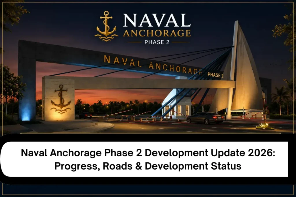
If you’re hunting for a Naval Anchorage Development Update, you probably want a straight answer. Has the work moved past brochures and billboards? I wish it were that simple, but one word like “developed” can’t carry the whole story.
Think about how a big site really looks. One road might be smooth and finished, yet nobody can tell you if water ever reached it. Meanwhile, a master plan might draw a lovely park where there’s only dust. In fact, two blocks that sit side by side can feel like different projects.
That’s why this guide keeps things apart. Physical work goes in one place and plans in another, while developer claims, market chatter and official records each get their own corner. Read it through, and you’ll be able to test an exact plot yourself before you buy into any development story.
Quick Development Status Table
| Development Factor | What the Record Shows | Source Type | What to Look For on Site |
| Main access | No dated source reviewed documents a finished, usable route into Phase II | Developer material | Drive from the nearest main road to the entrance and note surface and width |
| Internal roads | Road layout appears on the master plan, completed length is not documented | Master plan | Walk the street outside your plot and see if it is formed, based or paved |
| Plot demarcation | Plot layout appears on the master plan, physical markers are not documented | Master plan, developer material | Find boundary pegs and match the plot number, block and size to your file |
| Water | Water corridor is planned, no source reviewed documents supply at any block | Plan, developer material | Look for a running tap, tank or bulk line inside your block |
| Sewerage | Network is shown as planned, installed lines and live service are not documented | Plan | Look for manholes and laid lines near the plot |
| Electricity | Network is planned, no source documents poles or live connections | Plan | Look for poles, transformers and meters on nearby houses |
| Drainage | Drainage system is not documented for Phase II | Plan | Look at roadside drains and see where rainwater runs |
| Commercial areas | Marked on the plan, no active commercial area is documented | Plan | Look for open shops or construction on commercial plots |
| Parks/open spaces | Reserved on the plan, no landscaping is documented | Plan | Look for grass, paths and boundary works |
| Regulatory status | CDA’s June 1, 2026 notice says Phase-II (about 5,500 kanals, Zone 5) had development, marketing and sale activity without an approved LOP and NOC. Block-A (about 435 kanals) is discussed separately | CDA notice | Ask for the latest CDA letter that names Phase-II specifically |
Naval Anchorage Development Update 2026: What Has Changed?
Start with the one record nobody can spin. CDA’s June 1, 2026 notice describes Naval Anchorage (Phase-II) as an area of roughly 5,500 kanals in Zone 5, and it also raises an LOP and NOC issue for that land. Later, I’ll unpack that in its own section.
How much has actually been built is a separate question, and the sources I reviewed leave it open. For now, completion percentages, road lengths and the count of developed blocks all stay unconfirmed. So you won’t find a neat score here, but you will find the picture broken into parts, which is more honest.
Large sites rarely move at one speed. Somewhere there might be a grader working today, while a few hundred metres away the ground hasn’t been touched. Entrances usually look best because developers finish the bit visitors see first.
So I’d be careful with that first impression. A tidy gateway tells you how the gateway looks, full stop. However, your plot may be three streets in, and the story there can be completely different.
Next time somebody tells you “work is going on,” ask them which work. Roads? Grading? Pipes? Houses? Then ask how they know. Most vague updates fall apart at that second question.
Naval Anchorage Development Update: Main Access Roads
Roads are what buyers notice first. Unfortunately, they’re also where people get fooled most often.
Main Access Roads
People say “access” like it’s a single thing, but it’s really four. There’s the route toward the project, the entrance road, the connections around it and the roads inside. Each one can be at a different stage, so a good one doesn’t vouch for the others.
The Naval Anchorage Phase 2 location page shows where the project sits. Still, I couldn’t find proof in the evidence that any particular route is fully working today.
So try this on your own visit. First, drive to the project, then try to reach your actual plot from the gate. If that second part gets awkward, you’ve learned something.
Naval Anchorage Development: Internal Roads
Naval Anchorage internal roads split into two groups. Primary roads take the bulk of the traffic, while secondary residential streets run off them and reach individual plots.
Both groups follow a similar path of alignment, earthwork, base and paving, but they rarely advance together. As a result, a finished primary road says very little about the narrow street outside your plot.
And a line on a map? Nobody can drive on that. The difference sounds tiny until you’re standing at a plot you can’t reach.
Road Development vs Road Plan
Road work moves in seven steps, and it pays to know them in order:
- The road appears on the master plan.
- Surveyors mark the alignment.
- Earthwork begins.
- Crews finish road formation.
- Workers prepare the base.
- Contractors lay the surface.
- The road becomes physically usable.
You’ll see plenty of photos from step three or four captioned “roads completed.” So whenever a picture comes your way, work out which step it really shows.
What Buyers Should Check on Site
Once you’re standing on the ground, look at Naval Anchorage Phase 2 roads with this list in hand:
- Road width at the plot
- Surface condition
- Connection to the main route
- Drainage beside the road
- Access for construction vehicles
- Demarcation of surrounding plots
- Whether the road serves your exact plot
Also, take dated photos. Months later, when you go back, they settle arguments fast.
Naval Anchorage Infrastructure Development
Naval Anchorage infrastructure covers far more than tarmac. A plot becomes practical only when several layers come together, and one missing layer can stall everything.
Earthwork and Land Grading
Earthwork normally starts things off: leveling, grading, shaping the road lines and preparing plots. In practice, fresh grading or machines on site usually mean something is moving.
I won’t give you a completion percentage because nothing I reviewed supports one. Instead, make a call on the exact block you care about. After all, progress in one corner doesn’t carry over to the next.
Drainage Infrastructure
Rain shows what drainage is really worth. It controls runoff, damages or protects roads, blocks or allows construction access, and decides whether water pools around plots. Even so, a poor system can chew up a new road in a season or two.
The sources reviewed don’t document the exact Phase II drainage system. Therefore, visit after rain if you can and see where the water goes. Roadside drains tell you plenty.
Utility Corridors
On a plan, a utility corridor is just a strip of land set aside. Services might arrive years later, or never. In short, infrastructure shown on a plan is evidence of planning, not automatically evidence of completed service.
Physical signs matter more. For example, open trenches, laid pipes, new poles and cable work all suggest real progress. Even so, they only prove installation, and the next section explains why that still isn’t service.
Plot Demarcation and Site Development
A plot number in a file doesn’t mean you can find that plot on the ground. In fact, plenty of buyers hold a clean file and still can’t point at their land. So don’t let anyone wave at a map and call that proof.
Instead, insist on being taken to the spot. Look for boundary markers and street lines, then check that the plot number, block and size match what your documents say.
Naval Anchorage Phase 2 Utilities: What Is Actually Available?
Of everything in this guide, Naval Anchorage utilities need the most careful reading. Sales material loves “utilities included,” but keep this in mind instead: a planned utility isn’t an installed one, and an installed one may still not be working.
Water Supply
Water has three stages. First, the plan is what the project or master plan says. Next, installation is pipework that physically exists, and finally, operation is water actually arriving at the area.
Working supply at specific blocks could not be confirmed from the sources reviewed. So ask to see proof of supply at your own block and street, not somewhere nearby.
Sewerage
Sewerage runs on the same logic. A planned network is a drawing, while an installed one is physical work. Likewise, a connection means your plot can attach to it, and service means it truly functions.
Buried pipes and planned lines prove nothing about working sewerage. Therefore, ask who maintains the network, and whether a live connection sits close to your plot.
Electricity
Electricity has its own layers: a planned network, physical infrastructure, real availability and an actual connection. Any of them can differ from one spot to another. However, no reliable current source I reviewed confirms availability across Phase II, so current availability at the specific location should be independently verified.
Street Lighting and Other Services
Streetlights, gas and telecom only belong in a guide like this where evidence exists, and I found no verified record of them in Phase II. Still, if a seller mentions them, ask to see them on site.
Block-Level Development: Why the Overall Picture Can Be Misleading
Judging a huge project from one source gets risky quickly. The usual traps look like this:
- Entrance photographs
- One paved road
- One developed block
- A promotional video
- A single site visit
- A master-plan screenshot
A fixed order works better when you inspect. Begin with the phase, then the block, then the street and the plot. After that, check the road, the utilities and what surrounds the plot.
Here’s a scene that plays out all the time. A buyer visits a polished entrance, sees workers on the road and assumes all of Phase 2 looks like that. It’s an easy leap, but it needs evidence because the entrance might simply be the most finished part.
“Development has started” is a general line. Therefore, it can’t tell you whether your plot is ready. Besides, if you’re checking a particular plot, the main entrance is only the start.
Master Plan vs Actual Development
| Feature | Planned | Under Development | Operational |
| Road | Line drawn on the master plan | Pegs, cutting, earthwork or base work visible | Vehicles can drive from the main route to the plot |
| Water | Utility corridor marked on the plan | Trenches open and pipes being laid | Water reaches the block through a working line |
| Sewerage | Network drawn on the plan | Pipes and manholes being installed | Waste flows through a live line connected to the plot’s street |
| Electricity | Network drawn on the plan | Poles and cables being installed | Houses nearby run on a live connection |
| Park | Area reserved on the plan | Grading, planting or paths being built | People can walk in and use it |
| Commercial | Area marked on the plan | Buildings under construction | Shops open and trading |
Reading it is simple. “Planned” means the feature shows up in the plan or project material. Meanwhile, “under development” means somebody has started physical work, and “operational” means it does its job today.
To see the intended block and road layout, study the Naval Anchorage Phase 2 master plan. Additionally, the Naval Anchorage Phase 2 map post helps you get your bearings.
One thing to remember. A master plan shows what the project intends to build, but it can’t prove what’s finished. So treat every feature on it as a plan until you’ve seen it with your own eyes.
What the Latest CDA Record Means for Naval Anchorage Phase 2 Development
CDA’s June 1, 2026 notice is the most important regulatory record on this topic. It identifies development, marketing and sale activity for Naval Anchorage (Phase-II), covering approximately 5,500 kanals in Zone 5. According to the notice, that activity was going on without an approved LOP and NOC from CDA.
The notice also covers a separate area. It deals with approximately 435 kanals linked to Naval Anchorage Block-A and the way that land relates to the approved Jinnah Garden Phase-I Extension plan.
So CDA treats Phase-II on its own in this notice. Therefore, the original Naval Anchorage approval shouldn’t be read as automatic evidence for Phase-II. Instead, check the latest authority record rather than leaning on older NOC references. Our Naval Anchorage NOC status article follows this topic further.
What does that mean in practice? Development and approval are two different questions. The presence of development work does not itself establish the regulatory approval status of that development. It also works backwards, because an approved plan doesn’t prove every road or utility exists.
A few questions are worth carrying with you:
- Is physical development visible?
- What infrastructure is actually present?
- What does the latest authority record say?
- Does the approval shown specifically cover Phase II?
- Is someone presenting an older NOC as if it applies to the newer phase?
This article reports what the authority’s record says. However, it isn’t legal advice, and it doesn’t draw legal conclusions.
Naval Anchorage Islamabad Development vs Marketing Claims
Information about Naval Anchorage Islamabad reaches you from all directions, but the sources don’t deserve equal trust. Roughly four levels cover what you’ll hear.
CDA’s June 2026 notice states regulatory facts, so it sits at the top. Next, project material tells you what the developer plans or reports, while current listings show what sellers want you to notice. Finally, there’s the pile of claims nobody could confirm at all.
| Claim Type | How to Treat It |
| CDA record | Quote it with its date, and use it as the only source for regulatory facts |
| Developer statement | Write it as “project material says” and name the source |
| Master plan | Describe it as the intended layout until work is visible on site |
| Market listing | Describe it as what sellers advertise, and keep it out of status facts |
| Dealer statement | Hold it back until a document or site visit backs it up |
| Promotional blog | Use it only to find leads, and never as a source for facts |
A lower source should never overrule a higher official record. For example, suppose a dealer tells you a phase is fully authorized. Put that against the authority record before you believe a word. The same habit helps across the wider Naval society market, where claims spread fast through word of mouth and social posts.
Naval Anchorage Development: What Physical Progress Should You Look For?
Asking “has development started?” gets you a lazy answer. Instead, look for specific signs. They tend to show up in three stages.
Early Development Indicators
- Land clearing
- Grading
- Road cutting
- Plot demarcation
Intermediate Development Indicators
- Road base
- Drainage
- Utility installation
- Defined streets
- Plot accessibility
More Mature Development Indicators
- Usable roads
- Functioning utilities
- Construction activity
- Occupied properties
- Active commercial areas
- Streetlights and public infrastructure
Where a location lands on this scale shows how far work has really come. That said, none of these signs proves legal approval. In other words, physical progress and regulatory status stay separate checks.
How to Verify Naval Anchorage Development Before Buying
This is the section I’d save and reread. Project-level statements almost never answer plot-level questions. For example, “road development has started” doesn’t mean your plot has a usable road, and “utilities are planned” doesn’t mean your plot has working ones.
Verify the Exact Plot
Confirm the plot number, block, street and dimensions. Then go there and check the demarcation yourself.
Verify the Road
Is the road physically there, and is it paved? Does it connect to a usable route? Can construction vehicles reach the plot, and does drainage block them? Above all, does the road on the plan exist in real life? So ask all of this about Naval Anchorage Phase 2 roads around your plot specifically.
Verify Utilities
Check water, sewerage, electricity, drainage and street lighting one by one. “Utilities included” is not proof of service. Instead, ask for evidence at your exact block. That rule holds for Naval Anchorage utilities whichever phase you’re looking at.
Verify Surrounding Development
Look around the plot properly. Nearby houses, active construction, commercial activity and boundary works all tell a story. Likewise, utility work, road condition and patches of raw land say a lot.
Verify Documents
Before you hand over a single rupee, sit down with the seller’s papers. It could be an allotment letter or a transfer file, but the question is the same either way: does this person really have the right to sell this plot? Then check the plot number, phase and block on the paper against what they showed you on site.
They have to match. After that comes the part people tend to skip. Get the latest project documents and see what the authority record says right now, because an old NOC tells you nothing about today. Finally, ask where the LOP/NOC actually stands at this moment.
The Naval Anchorage Phase 2 payment plan page helps you compare what you’re shown against official terms. Still, remember that development progress is not a substitute for document verification.
What “Development Progress” Means for Different Buyers
If You Want to Build Soon
You need a usable road, a plot you can locate, water, sewerage and electricity. Construction access and the neighbourhood around the plot matter too. After all, if a truck can’t bring bricks to your plot, it isn’t ready to build on.
If You Are Considering a Longer Holding Period
Focus on real execution, the order in which work happens and the regulatory position. Infrastructure commitments and market liquidity deserve a look as well. Meanwhile, I’m not predicting future appreciation here, and nobody can promise it either.
If You Already Own a Plot
Compare what you see today with your last visit. Note road progress, new utilities, nearby construction and changes in your block. Also, check whether your documents need updating after any change in the authority record.
Naval Anchorage Update: What Is Confirmed and What Still Needs Verification?
| Topic | What Can Be Said | What Is Not Documented |
| Phase-II development activity | CDA’s record identifies development, marketing and sale activity | How much land has been developed |
| Main roads | No dated source reviewed shows a finished route | Width, surface and length |
| Internal roads | Layout is on the master plan | Which streets are formed, based or paved |
| Plot demarcation | Plot layout is on the master plan | Which plots have physical markers |
| Water | Corridor is planned | Pipes laid, tanks built or supply running |
| Sewerage | Network is planned | Lines laid or live connections |
| Electricity | Network is planned | Poles erected or connections live |
| Parks | Areas are reserved on the plan | Any landscaping or usable space |
| Commercial | Areas are marked on the plan | Any building or active shop |
| Phase-II LOP/NOC | CDA’s June 1, 2026 notice says there was none approved for Phase-II | Any newer CDA record on Phase-II |
| Original Naval Anchorage approval | Treated as a separate record | Any CDA document extending it to Phase-II |
| Full project development | Cannot be stated for the whole of Phase-II | Block-by-block progress |
For planned amenities, see the Naval Anchorage Phase 2 facilities page. Likewise, the commercial plots page covers commercial areas. Treat both as project material until you’ve seen them on site.
Conclusion
The development picture for Naval Anchorage Phase 2 is mixed, and it changes from one area to the next. CDA’s record identifies development activity, but how much work is actually complete needs on-site confirmation. Overall, no single label fits the whole project.
Roads, utilities, infrastructure and block-level progress each need their own check. A visible road doesn’t prove working utilities, and a master plan doesn’t prove completion. So inspect your exact street, not just the entrance.
Regulatory status needs its own check as well. Since CDA’s June 2026 notice treats Phase-II separately, don’t assume older NOC references apply. Instead, read the latest authority record before you rely on any claim.
The useful question is not simply whether Naval Anchorage Phase 2 is developing. The useful question is how far development has reached at the exact location you are considering, and which claims are supported by current records.
Frequently Asked Questions
Q1: What is the latest Naval Anchorage Development Update in 2026?
Ans: CDA’s June 1, 2026 notice is the latest official record reviewed. It identifies Phase-II as a separate area of about 5,500 kanals in Zone 5 and raises an LOP/NOC issue.
Q2: Is Naval Anchorage Phase 2 fully developed?
Ans: The sources reviewed couldn’t confirm that. “Fully developed” would need evidence across roads, utilities, plots and amenities, but no single source covers all of it.
Q3: Are Naval Anchorage Phase 2 roads developed?
Ans: Main access, internal roads and access to your exact plot are three separate questions, so each needs its own check. In practice, a usable main road doesn’t guarantee a usable street at your plot.
Q4: Are Naval Anchorage utilities available?
Ans: Planned, installed and operational utilities are different stages. Therefore, current availability at a specific location should be independently verified, and you should ask for proof at the exact block.
Q5: What is the current Naval Anchorage Phase 2 development status?
Ans: It depends on the area. CDA’s record identifies some development activity, but extent, usability and utility service still need confirmation. As a result, no single label fits the whole project.
Q6: Is Naval Anchorage Phase 2 approved by CDA?
Ans: CDA’s June 2026 notice states that Phase-II development, marketing and sale activity was taking place without an approved LOP and NOC. Besides, the original Naval Anchorage approval shouldn’t be treated as proof for Phase II. So check the latest authority record.